. Staten Island News.")

In NYC, Weigh In Motion Ticketing Technology Effective, Now Expanded In State Budget, Redesign Of Conduit Corridor Pedestrian Safety
NYC DOT TO EXPAND EFFORTS TO PROTECT INFRASTRUCTURE FROM OVERWEIGHT VEHICLES THANKS TO NEW STATE AUTHORIZATION
The New York State Budget Expands NYC DOT’s Authority To Use First-in-Nation Weigh-in-Motion (WIM) Automated Enforcement To Crack Down on Overweight Vehicles
WIM Technology Has Resulted in a 60 Percent Decline in Overweight Vehicles on the Brooklyn Queens Expressway Over Its First Year of Use After It Was Authorized by the State
Editor’s note: This success was covered earlier this year when DOT announced its expansion. Signs of success were discussed early in the implementation period. Most drivers only needed one ticket to stop bringing their overweight vehicles on the highway. The goal is to preserve this existing infrastructure for as long as possible since replacement would be expensive. A recent street redesign was completed near the Brooklyn/ Queens border by the DOT.
NEW YORK — New York City Department of Transportation (NYC DOT) Commissioner Ydanis Rodriguez announced that the agency will expand its efforts to protect transportation infrastructure from harmful wear and tear caused by overweight vehicles. The expansion is a result of new state authorizations included in the New York State Fiscal Year 2026 budget. In 2021, the State of New York gave NYC DOT exclusive authority to use weigh-in-motion (WIM) technology to efficiently enforce penalties on the number of overweight vehicles on the Brooklyn Queens Expressway (BQE). This technology, which uses roadway weight sensors and enforcement cameras to issue violations to overweight vehicles, resulted in a 60 percent reduction in overweight vehicles on the BQE. This year’s state budget authorizes the use of WIM in an additional 14 locations in New York state, including nine city-owned bridges and highways managed by NYC DOT
“Weigh-in-motion technology has significantly reduced the number of overweight trucks on the BQE— now, with deep thanks to Governor Hochul, the New York State Legislature, and the hard work of advocates and NYCDOT, we can expand this effective tool across New York City,” said Deputy Mayor for Operations Jeff Roth. “This will help us prioritize work and protect our infrastructure in the long term. That is government innovation at its best.”
“Overweight vehicles damage our transportation infrastructure, and we all pay the price through costly maintenance and repairs,” said NYC DOT Commissioner Ydanis Rodriguez. “Thanks to Governor Kathy Hochul and legislative leaders, we will now have another highly-effective way to protect more of our infrastructure and make those who damage it with overweight vehicles pick up the tab for costly maintenance and repairs.”

The budget authorizes the use of WIM to protect the following 15 locations:
NYC DOT-Owned:
BQE Route I-278 in Kings County (Atlantic to Sands)
Greenpoint avenue bridge over Newtown Creek
Metropolitan Avenue Bridge over Newtown Creek
Hamilton Avenue Bridge over the Gowanus Canal
Williamsburg Bridge
Ed Koch Queensboro Bridge (State Route 25)
Third Avenue Bridge over the Harlem River
Manhattan Bridge
Long Island Expressway (Interstate Route 495) over Woodhaven Boulevard
Non-NYC DOT-Owned in NYC:
RFK Bridge
George Washington Bridge
NYS-Owned outside NYC:
Bear Mountain Bridge
Newburgh Beacon Bridge
Mid-Hudson Bridge
NYS Thruway Interchange 34-A near Syracuse
The adopted budget authorizes the technology to be used for five years, and the agreement also renews the automated enforcement program on the Brooklyn Queens Expressway (BQE) for the city-owned section between Atlantic Avenue and Sands Street. NYC DOT was previously authorized to use WIM on this stretch of roadway by legislation sponsored by New York State Senator Andrew Gounardes and New York State Assemblymember Jo Anne Simon.
WIM is Effective on the BQE
Since NYC DOT began WIM enforcement in 2023, the system has proven to be an incredibly effective tool at deterring overweight trucks from using the BQE in downtown Brooklyn. As of November 2024, overweight vehicles detected on the aging piece of infrastructure had decreased by 60 percent, as noted in NYC DOT’s 2024 WIM Report.
The WIM system technology utilizes roadway sensors to weigh passing vehicles in conjunction with adjacent cameras to capture the identifying information of vehicles that are overweight. Using this technology, those that violate the state maximum weight limit for their truck’s weight/vehicle class are issued a $650 violation. For example, WIM legislation grants a 10 percent gross weight overage — so a truck whose maximum gross vehicle weight is 40 tons is allowed to weigh 44 tons before a violation is issued. Prior to the use of this technology, NYC DOT found an average of 7,920 overweight vehicles driving in the Queens-bound direction on the city-owned portion of the BQE each month. During the first year of the use of WIM technology, this figure dropped to 3,041 vehicles on average.
WIM Across the Country
While WIM technology has been used across the country to screen and monitor for overweight vehicles, New York State became the first state to authorize direct enforcement when it was permitted for use on the BQE. With the expansion of the program to other critical infrastructure in New York City and beyond, and as other transportation partners around the country pursue this highly effective method to protect transportation infrastructure, the need for national standards becomes more urgent. NYC DOT continues to advocate for the national standards to be included in future iterations of the National Institute of Standards and Technology (NIST) Handbook so additional city and state governments can effectively implement this important and innovative tool. Proposed updates to address this need has the potential to be adopted via vote at the National Council on Weights and Measures’s annual conference this July.
NYC DOT LAUNCHES PROCESS TO REDESIGN CONDUIT CORRIDOR IN BROOKLYN AND QUEENS TO ENHANCE SAFETY AND PEDESTRIAN ACCESSIBILITY
In the Past Five Years on the Conduit Between Atlantic Avenue and Lefferts Boulevard, There Have Been More Than 40 Severe Injuries and Five Deaths
Adams Administration To Hold Community Workshops for New Yorkers To Share Ideas About Improvements Along the Conduit Avenue Corridor

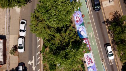
South Conduit Avenue and 79th Street, in Queens. NYC DOT redesigned North and South Conduit Avenue at 79th Street in 2023 to add new traffic signals, crosswalks, and a new sidewalk across the Conduit median. Image Credit – NYC DOT
NEW YORK – New York City Department of Transportation (NYC DOT) Commissioner Ydanis Rodriguez announced the launch of a new community-driven study to redesign Conduit Avenue in Brooklyn and Queens, a major, three-mile arterial street that connects Atlantic Avenue and Linden Boulevard in Brooklyn to the Belt Parkway and JFK Airport in Queens. In the past five years on the Conduit between Atlantic Avenue and Lefferts Boulevard, there have been more than 40 severe injuries and five traffic deaths. Heavy through-traffic and limited pedestrian infrastructure leaves community members with few options for safe travel along and across this stretch of roadway. Informal, unpaved pathways across the median show a desire for improved pedestrian access while speed cameras along Conduit Boulevard consistently log the highest number of speed violations of any locations citywide, suggesting a need for a redesign that reduces instances of reckless driving behavior. To help address safety and pedestrian accessibility concerns, later this month, community members will have the opportunity to share ideas for the future of the roadway at workshops in neighborhoods along the corridor.
NYC DOT will host a series of community workshops starting in June 2025 to hear from residents about what a redesigned Conduit corridor could look and feel like. New Yorkers can also share feedback on NYC DOT’s feedback map of the corridor.
“Brooklyn and Queens Residents deserve a Conduit Boulevard that improves daily life, not a roadway that puts pedestrians and drivers at risk and physically divides entire neighborhoods,” said NYC DOT Commissioner Ydanis Rodriguez. “Now is the time to let your voice be heard; at community workshops this month, we want to hear what New Yorkers think The Conduit should look like, and how it should serve our communities. It is time to let New Yorkers decide how the Conduit corridor can best serve the needs of the locals who use it most, while keeping them safe.”
“Accessible, safe pathways for pedestrians are crucial for welcoming New Yorkers and visitors into our city’s greenspaces, and we look forward to bringing together community members from Brooklyn and Queens for a conversation about optimizing public space on Conduit Avenue,” said NYC Parks Commissioner Sue Donoghue. “We invite everyone who uses the many parks in nearby areas to Conduit Avenue to share their voices during this transformative opportunity for the community.”
“From the Atlantic Avenue Mixed-Use Plan to the East New York Neighborhood Plan and beyond, improving streetscapes is key to City Planning’s comprehensive planning work,” said Department of City Planning Director Dan Garodnick. “We are proud to support this initiative to make Conduit Avenue a safer, more accessible corridor for pedestrians, drivers, and surrounding communities.”
From 1934 to 1940, the city widened Conduit Avenue, severing neighborhoods in Brooklyn and Queens as part of a broader vision to reimagine the outer boroughs for car travel, steam rolling working class neighborhoods in the process. The roadways were initially built to function as arterials alongside a larger elevated highway that would have been constructed in between them–but was never built.

South Conduit Boulevard, at Grant Avenue, in Brooklyn. Image Credit – NYC DOT
The abandoned plans for an elevated highway left a large, unused median between the east and westbound Conduit that contributes to nearly 61 acres of open space along the corridor, roughly the size of 46 football fields.
Looking Forward
The community-driven study will explore a redesign along the Conduit corridor between Atlantic Avenue in Brooklyn and Lefferts Boulevard in Queens, which is named Conduit Boulevard in Brooklyn and Conduit Avenue in Queens.
The Conduit is a critical connection for freight traveling between Atlantic Avenue and Long Island, but there are just 15 signalized pedestrian crossings along the entire three miles of roadway between Atlantic Avenue and Lefferts Boulevard. There are also 29 schools within 05. miles of Conduit.
The study will build on the agency’s prior safety efforts along the Conduit. NYC DOT has implemented several safety improvements along the corridor in recent years, including a reduced speed limit, new speed cameras, and several new pedestrian head-start signals at major crossings. In 2023, NYC DOT installed a new sidewalk and signalized crosswalks along North and South Conduit Avenue at 79th Street to safely connect pedestrians to a nearby shopping plaza.
Upcoming Workshops
NYC DOT will host two upcoming workshops for New Yorkers to share feedback directly, one in-person and one virtual session. The agency also encourages New Yorkers to share any thoughts online on the Conduit Corridor Project Feedback Map.
In-Person
Date: Tuesday, June 10, 2025
Time: 7:00pm – 8:30pm
Location: Robert H. Goddard JHS 202, 138-30 Lafayette St, Ozone Park, NY 11417
Virtual
Date: Thursday, June 12, 2025
Time: 7:00pm – 8:30pm
The workshop will be held as a Zoom meeting and will run from 7:00-8:30 PM.
“As an advocate for safer neighborhoods with better accessibility, I support the DOT’s initiative to redesign Conduit Avenue. This project addresses many safety concerns including dangerous driving. It aims to create a welcoming environment for pedestrians, bicyclists, and all residents,” said Senator Joseph P. Addabbo Jr. “Our community deserves infrastructure that puts safety and connectivity first, all while taking into account the thoughts and concerns of the residents. I will work with all stakeholders to ensure a safer and more equitable Conduit corridor that will benefit future generations.”
“For years, the Conduit has been one of the most dangerous corridors in our city — falling significantly short of meeting the safety needs of drivers, cyclists, and pedestrians alike. But thanks to the advocacy of many city and community partners, I’m proud to say that a study to redesign Conduit Avenue is finally getting underway,” said Queens Borough President Donovan Richards Jr. “No matter how you use our roadways, you deserve to get to your destination safely. That’s the ultimate goal of this Conduit Avenue study, and I encourage everyone from South Queens or East Brooklyn to make your voices heard as we center the surrounding community in reimagining this critical corridor.”
“Communities along Conduit Avenue have lived with unsafe conditions and disconnected streets for far too long,” said New York City Council Majority Whip Selvena N. Brooks-Powers. “As chair of the Council’s Committee on Transportation and Infrastructure and a representative of Southeast Queens, I will continue working with the Department of Transportation and advocating for investments to make our streets safer, more accessible, and more connected for the families who live and work in New York City.”
“For too long, the city has ignored the need for safer crossings and better infrastructure along this corridor, so it’s encouraging to finally see that changing,” said Councilmember Joann Ariola. “These new improvements will go a long way towards ensuring the safety of everyone, and avoiding any more unnecessary tragedies in the future.”
Banner Image: South Conduit Avenue and 79th Street, in Queens. NYC DOT redesigned North and South Conduit Avenue at 79th Street in 2023 to add new traffic signals, crosswalks, and a new sidewalk across the Conduit median. Credit: NYC DOT

NYC DOT
The New York City Department of Transportation’s (NYC DOT) mission is to provide for the safe, efficient, and environmentally responsible movement of people and goods in the City of New York and to maintain and enhance the transportation infrastructure crucial to the economic vitality and quality of life of our primary customers, City residents.
There are no comments yet
Why not be the first